top of page

-
Media Coverage
-
Data Collection
-
Site Survey/Mapping
-
3D Modeling


Looking for Drone Services for:
And More
We have you covered!
Site Mapping, Overview, and Overlay
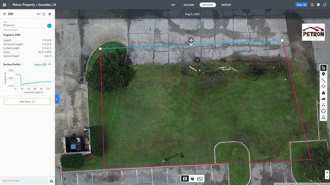
Working on a site and need to lay out construction plans? Or just need a quick overview of how your site looks for project planning? In a matter of minutes, we can fly over your site and give you a detailed 2D map of your site! We can even compare old sites to more recent ones so you can see your developing site grow!
Elevation and Topography
Need to know what you're working with height-wise? After flying over your site we can compile various types of data for whatever you need, including elevation. We can export it in any format that you are accustomed to! From contour lines of specified height to color-coordinated elevation markings, to even area watershed, we can help!
Cut and Fill Analysis, 3D Modeling, and Volume Metrics.
We're no stranger to working in a 3D environment, we do it every day! We also extract data from the environments we work in to help with projects and task at hand. From Cut fill Analysis, to help level dirt work on a developing site, to measuring the volume of a pile of gravel to get an accurate assessment on how much gravel you have left for the rest of your job, we're here to help.
Site Measurements and Metrics
A project revolves around accurate data and measurements to plan and implement! We can get that information for you and manipulate that data to your benefit! Need to find the area of your property? Or need to find out how far out your construction is from your property line? It's just one of the many assets we have available to help you with any project you have! Just try us!
At Petron, Our Services include
bottom of page


